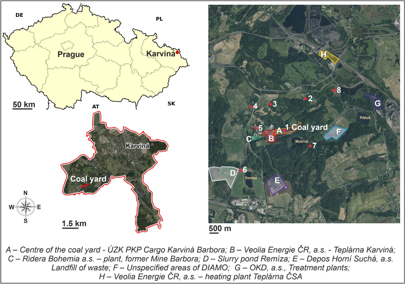
Despite the increasing share of renewable energy sources in the global energy mix, coal remains a significant fuel and a key raw material for certain industrial sectors. The use of drones represents an important method for obtaining more precise information about air pollution and the behavior of specific pollutants that may disperse from coal stockpiles. Coal particles are released into the surrounding environment during handling operations or as a result of weather conditions.
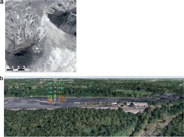
The study confirmed that open coal storage does not have a substantial negative impact on air quality in the immediate vicinity of the stockpile. The dispersion range of coal particles from the storage site extends up to a maximum of 500 to 1,000 meters. The spatial (vertical) distribution of particles was monitored for black carbon (BC) and particulate matter (PM₁₀) at heights of 1 m, 30 m, and 60 m above the surface of the coal heap.
The average concentration of BC decreases with height above the stockpile. The highest average concentration of BC above the center of the coal heap was recorded at a height of 1 meter. Based on the findings and in comparison with background levels, it was determined that approximately 17% of BC particles in this location originate from coal-related activities. The average proportion of coal-derived particles in PM₁₀ was nearly identical across different measured heights and locations, clearly indicating that the coal stockpile does not contribute significantly to ambient pollution levels. The limited vertical dispersion further confirms the restricted spatial reach of coal-related emissions.
Drones enable detailed measurements of particulate concentrations in the air, including vertical profiling. These data provide greater insight into so-called fugitive emissions, which are pollutant releases from uncontrolled sources. Understanding the distribution of such particles is essential for setting safer pollution thresholds, which in turn help minimize environmental impact.
Collecting accurate and detailed data on air quality in the vicinity of industrial zones, such as coal storage areas, is a vital tool for effective and responsible urban planning. Such information can significantly assist municipal representatives in designing appropriate urban development strategies — including the placement of green spaces, the selection of residential zones, and the planning of irrigation systems for public areas.
Based on the measurement data, city officials can also estimate budgets for environmental care and target investments into measures with demonstrable health and quality-of-life benefits for residents. These results are equally valuable for industrial partners, as they offer a foundation for technology upgrades and the design of more sustainable operational processes.
Modern measurement technologies, such as drones, thus demonstrate how we can better understand our surrounding environment and contribute to its responsible development. The outcomes of such research open up space for constructive dialogue and the search for balanced solutions that respect both the needs of industry and the well-being of local populations.